blah blah blah
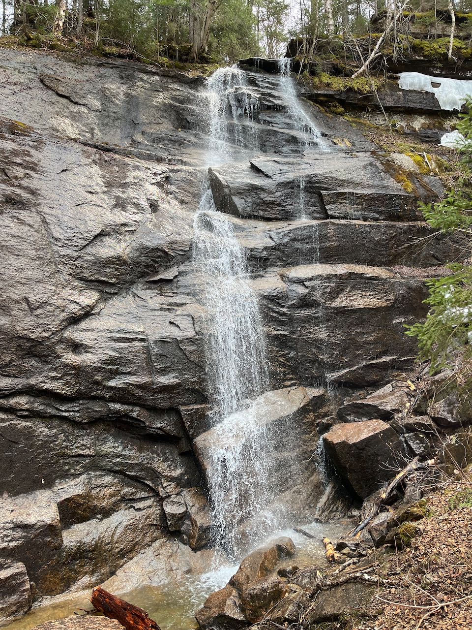
Noble Falls
Length: 1.0 mile out-and-backDifficulty (click for info): Easy
Elevation Gain: 90 feet (+120 feet on return)
Rating (click for info): 7/10
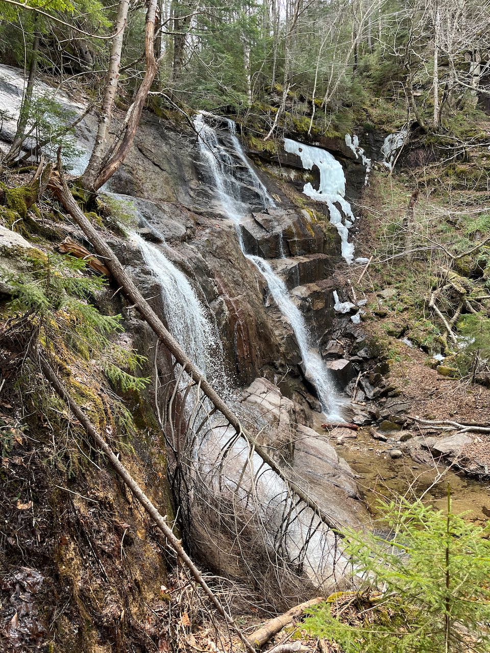
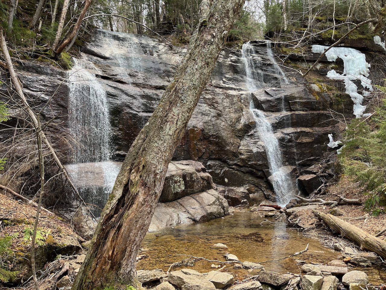
Height: 50'
Driving Directions:
Trailhead and parking area are on Alpen Hill Road in Franconia, NH. From exit 34C off I-93, drive west on Rt. 18, passing by the entrance to the base lot at Cannon Mountain Ski Area. After 0.8 miles, turn left onto Mittersill Road at a signpost for the Mittersill Alpine Resort. Drive 0.4 miles into the resort complex, and turn left after passing through the parking lot around the main building. Stay straight up the hill, avoiding the roads splitting off to the right. The road bends to the right, climbing the hill, and after about 0.3 miles from the main building, stop in a pull-off at the end of a hairpin turn to the left. The trail will take off at the back of this parking spot. Click here for a Google map.
About the Hike:
You will not find Noble Falls on any White Mountain tourist brochures, although it may have the scenic potential to qualify. Two factors hold it back from mainstream awareness. First is that to locate it, you must hike on an unofficial, locally maintained path that is not incorporated into the trail network of the national forest. Second is that Noble, also known colloquially as Bridesmaid Falls, due to its proximity to Bridal Veil Falls, is one of those waterfalls that has a narrow window of opportunity in the early spring in which to view it in its proper glory. Otherwise, the greater portion of the brook that generates it will be dried up. But if you have the chance to find it in April or May while the snow is still melting, the full height of Noble Falls is a stunning sight to rival many acclaimed White Mountain waterfalls.
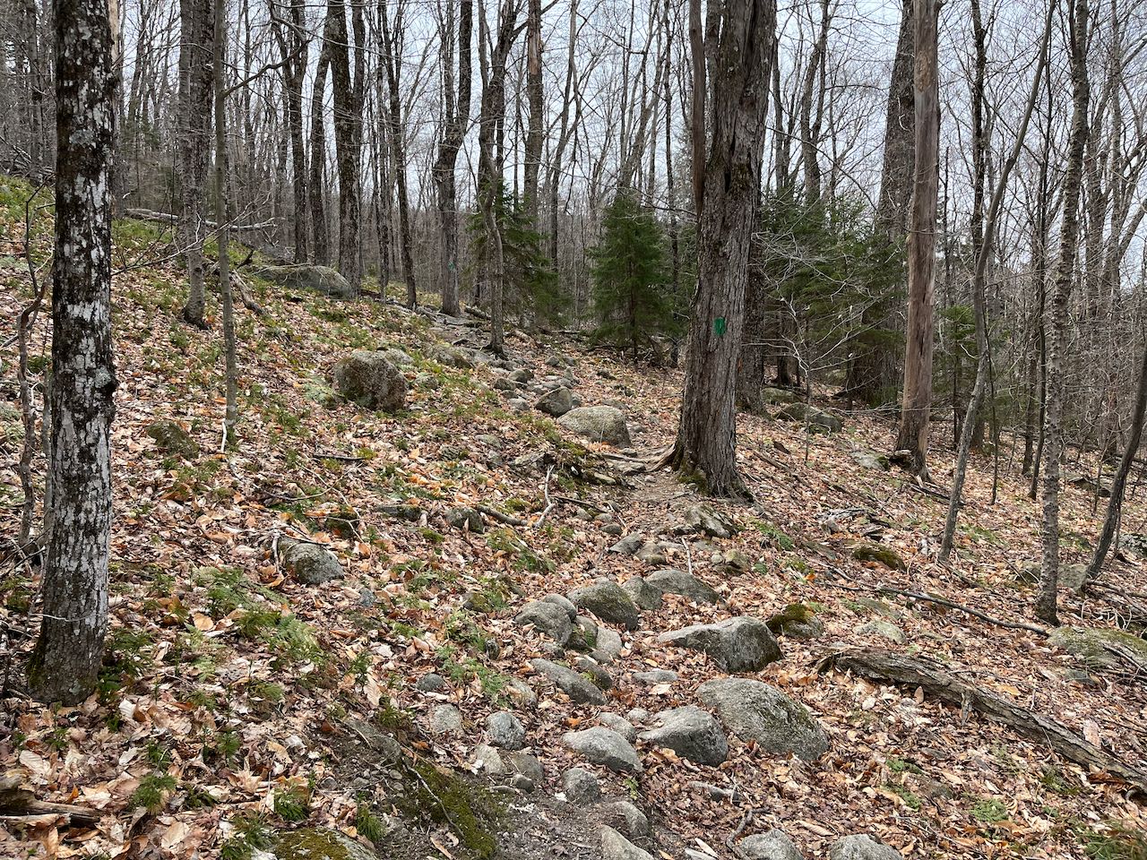
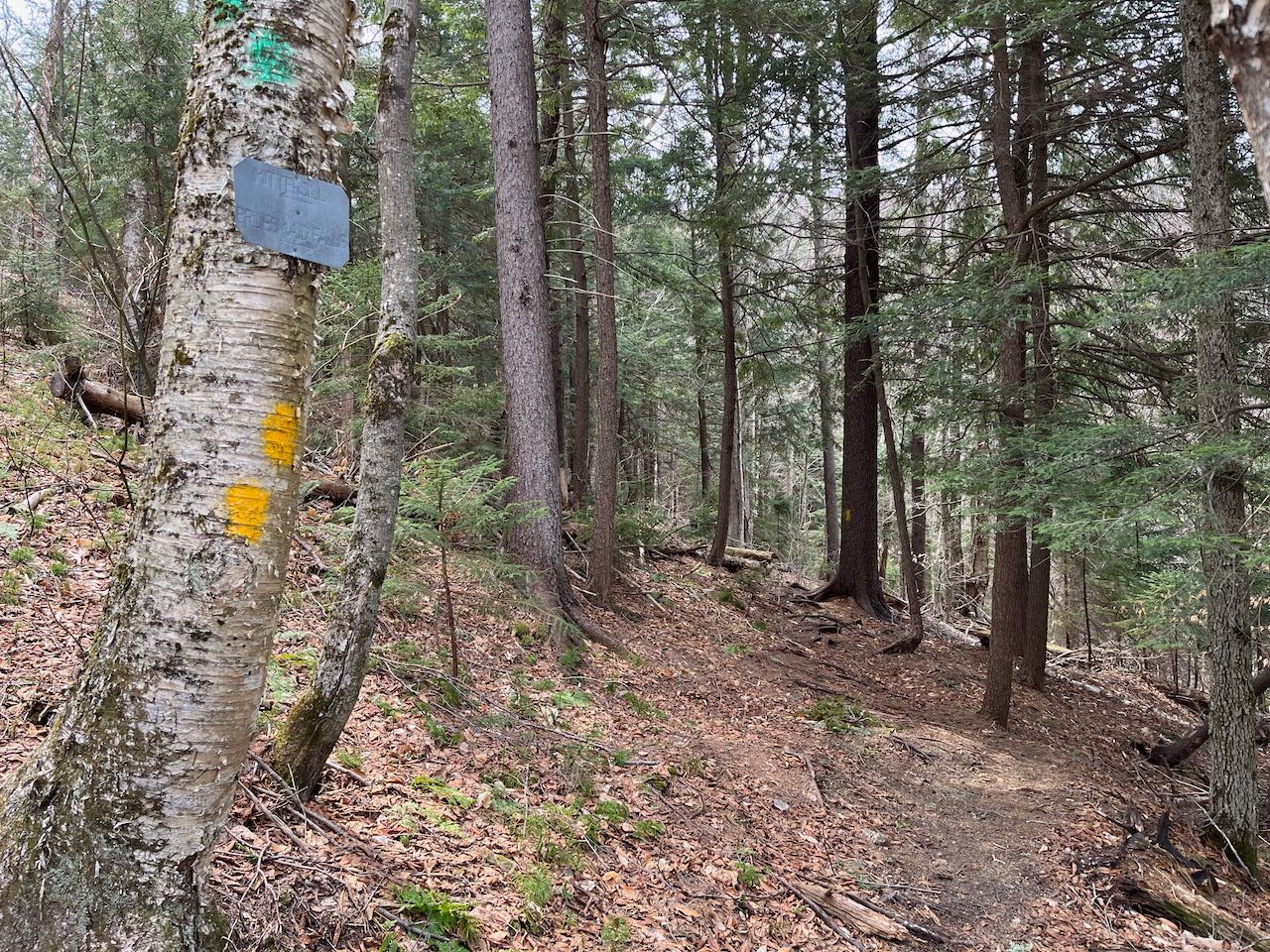
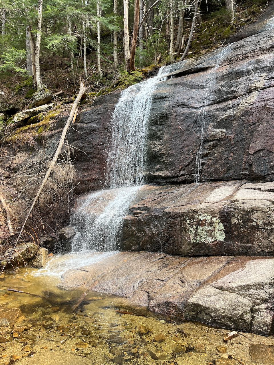
Set out from the road on an unsigned but clear footpath down an embankment into the forest. In about 200 feet, merge with another path coming in from a different road on the right. The trail is now blazed in green. Enjoy a casual meander across the hillside in the bright, verdant woods with some occasional stony footing. After about 0.1 miles, stay left as a red-blazed trail splits off to the right. In another 0.3, leave the green trail behind at a tin sign and bear right onto a path marked with yellow. At this point, the trail takes a turn into a darker hemlock stand and begins to drop into the valley of Meadow Brook. Use caution as you make your way down the sharp embankment in the last 0.1 miles, aided by a rope strung from tree to tree as a handrail. The waterfall comes into view as you round the corner and come down to the level of the brook. Cross a branch of the outflow and arrive at a rocky landing point beside the shallow, bubbly pool at the base of the cataract. Here at this mountain oasis, hemmed in by two sharp walls of boulders, two branches of the small stream tumble over a 50-foot cliff and merge in the pool below. In early spring flow conditions, the two forks will fan out gracefully over the smooth rock. Several other waterfalls lie concealed through the woods up and downstream of the main waterfall for hardier adventurers to locate.
Printable directions page